

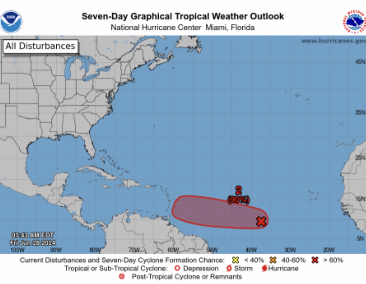
THE Trinidad and Tobago Meteorological Service (TTMS) monitors an area of low pressure, AL95 near the central Tropical Atlantic.
Additionally, the system is expected to continue moving west-northwest and develop into a tropical cyclone within the next one to two days.

An update at 8 am on Friday, TTMS stated the area of active weather associated with the low was centred near 38 W longitude (near 2400 km), east-southeast of the southern Windward Islands.
“Showers and thunderstorms associated with the low continue to become more organised, and environmental conditions are expected to remain conducive,” the Met Office stated.

The US National Hurricane Centre (NHC) gave the system a 90% chance of developing into a Tropical Cyclone over the next 48 hours and a 90 % chance of development through seven days.
At this time, the Met Office stated the system posed no direct threat to Trinidad and Tobago.
However, TTMS stated that the initial outlook for Trinidad and Tobago was cloudy skies with showers and a medium chance of thunderstorm activity by July 1. And seas conditions are expected to become further agitated, particularly along western and northern coastlines.
![]()