

Hurricane Erin is strengthening and forecasters Monday warned that it is expected to “grow even larger.”
The Miami-based National Hurricane Center (NHC) said that the first named hurricane of the 2025 Atlantic season was now 110 miles north of Grand Turk with maximum sustained winds of 140 miles per hour (mph).
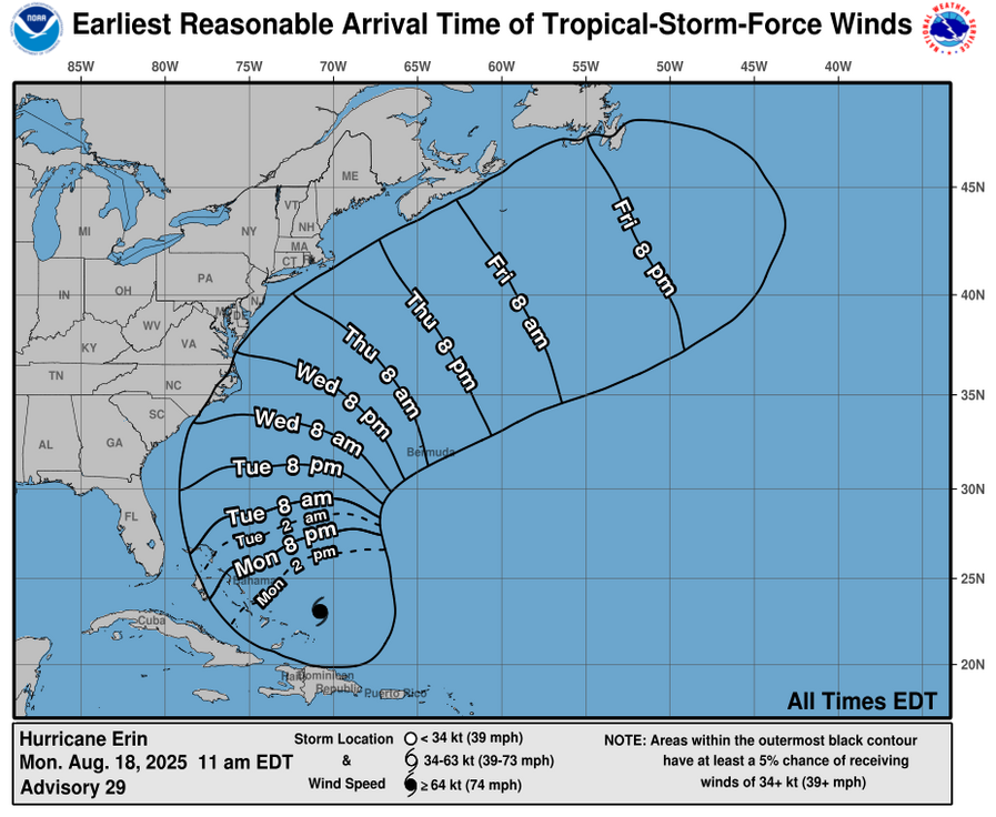
A Tropical Storm Warning is in effect for the Turks and Caicos Islands, Southeast Bahamas, while a Tropical Storm Watch is in effect for Central Bahamas. The NHC said that interests in the northwestern Bahamas and Bermuda should monitor the progress of Erin.

According to the latest weather bulletin, the center of Hurricane Erin was located near latitude 23.1 North, longitude 70.8 West and Erin is moving toward the west-northwest near 10 mph.
“A turn to the northwest is expected later today, followed by a turn to the north and on Tuesday. On the forecast track, the core of Erin is expected to pass to the east of the southeastern Bahamas today and move between Bermuda and the east coast of the United States by the middle of the week.”
Erin is a category 4 hurricane on the Saffir-Simpson Hurricane Wind Scale and some additional strengthening is expected today. Erin will remain a dangerous major hurricane through the middle of this week.

The outer bands of Erin will produce localized areas of heavy rainfall across portions of Hispaniola through today and through Tuesday for the Turks and Caicos and the Bahamas east from San Salvador Island.
Tropical storm conditions are expected today across the Turks and Caicos Islands and the southeast Bahamas. Tropical storm conditions are possible in portions of the central Bahamas late today through Tuesday. (CMC)
![]()